
The Éislek region in northern Luxembourg is crisscrossed by valleys and plateaus with panoramic views, medieval castles and idyllic villages. We are on a section of the 52-kilometer Leading Quality Trail – Best of Europe. The entire trail can be completed in three days and leads from Ettelbrück to Kautenbach. It is a hiking pleasure with 2,000 meters of altitude gain that rewards you with great views. Lee means rocky ridge in Luxembourgish and the Escapardenne Lee Trail offers plenty of them.
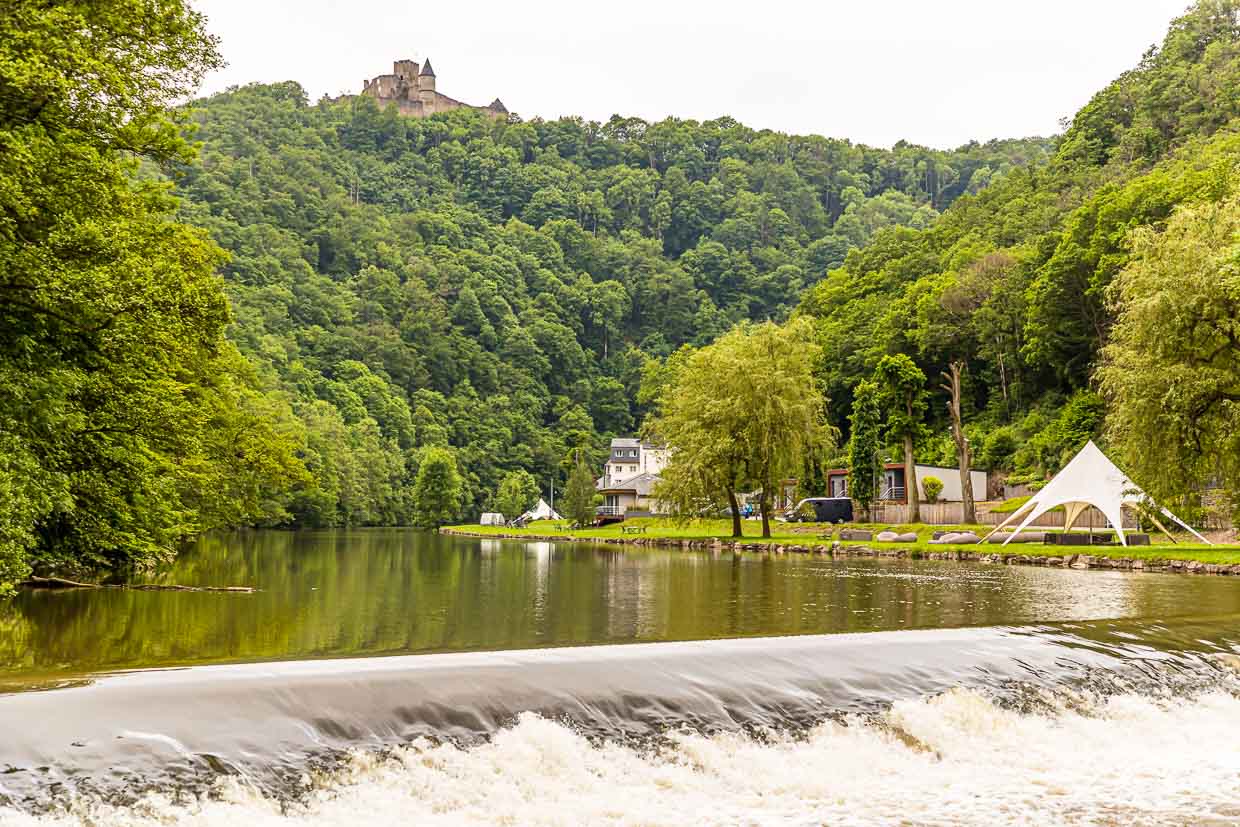

The middle stage of the Escapadenne Lee Trail is 19 kilometers long and, with a good 900 meters of altitude gain, also the most demanding of the three sections through the Éislek region. It goes from Bourscheid-Moulin on the Sûre River to Hoscheid on the Ardennes plateau. In Burscheid-Moulin there are numerous accommodation options. Two hotels, cottage suites overlooking the river, and also a campground line the banks.

You should pack a lunch for this stage, as there are no places to stop along the way. Enchanted forest paths, rocky outcrops, lonely valleys, passages with blooming broom and every now and then a mountain ridge with a good view, however, offer many picnic opportunities. The sign of the white wave on a blue background is the official logo of the trail and accompanies you reliably along the entire route. In between there are always stage signs of the Escapardenne Lee Trail. Despite the good signposting, it is recommended to switch on a hiking app as your own backup.


Once you have left Burscheid behind, the next hiking stop is the Napoleonsknäppchen, also called Napoleonsbäumchen. It is located on a high plateau and is visible from afar. Except for a tree and the viewing platform, there is – almost – nothing else to see here. However, a farmer has placed a huge and also clearly visible manure pile next to the tree. This seems disrespectful at first, but maybe it’s good for the tree itself.

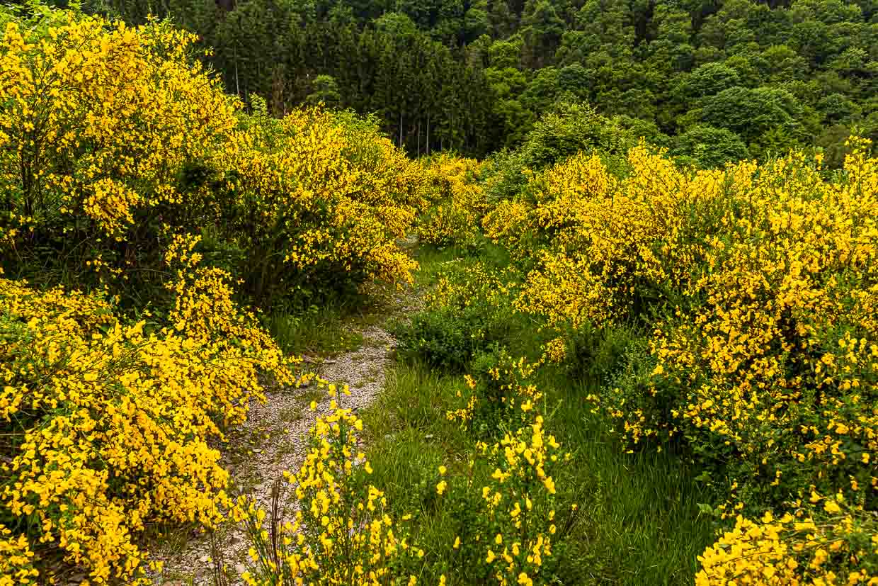
Back to the historical significance of the Napoleon’s Knapchen. The original tree was planted in 1811 in honor of the birth of Napoleon Bonaparte’s son. In 1940, this tree was cut down by the Nazis. But only a year later the local residents planted that linden tree, which still stands there today. After the excursion across the plateau, we continue through gorse bushes, which bloom profusely in June, and back into the forest.

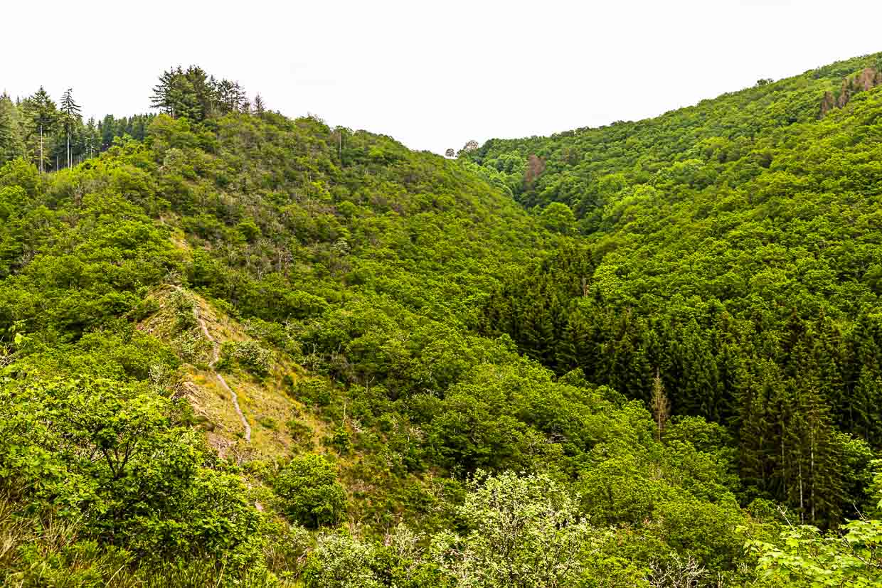
What follows now is definitely one of the highlights of the trail. Via a steep path you climb the Molberlee ridge. It is a narrow path a good 500 meters long. To the left and to the right the only sparsely overgrown rock drops steeply. One walks over almost fine-leaved slates. The Mollbier, in German Heidelbeere, gives the ridge its name. This point is certainly one of the most beautiful in the Luxembourg Ardennes. The stage ends on a high plateau in the village of Hoscheid.
Boarding please! Free ride through Luxembourg
The Éislek region in the Luxembourg Ardennes is one of five regions we explored on foot. We covered the distances between the daily stages by bus and train. Luxembourg offers its residents and visitors alike free public transportation throughout the country. Ticket booths have therefore had their day in the Grand Duchy. And with the nationwide Move We Carry service, we walked during the day without a care in the world, while our suitcases traveled from accommodation to accommodation with the luggage service. Up to six consecutive days can be booked online.
The Éislek region in the north of Luxembourg is dotted with valleys and plateaus with panoramic views, medieval castles and idyllic villages. We hike a section of the 52-kilometer Leading Quality Trail – Best of Europe from Bourscheid-Moulin to Hoscheid. The entire trail can be completed in three days and leads from Ettelbrück to Kautenbach. A hiking pleasure with 2,000 meters of altitude, which rewards you with great views. Lee means ridge in Luxembourgish and the Escarpadenne Lee Trail offers plenty of ridges.
The middle stage of the Escapardenne Lee Trail is 19 kilometers long and, with a good 900 meters of altitude gain, also the most demanding of the three sections through the Éislek region. It goes from Bourscheid-Moulin on the Sûre River to Hoscheid on the Ardennes plateau. In Burscheid-Moulin, there are numerous accommodations. Two hotels as well as cottage suites overlooking the river and also a campground line the banks.
Material
What format do you need? A report with news value, an entertaining report, a short travel tip or a picture gallery? At the international photo agency Alamy you can see all the photos of Georg Berg about hiking in Luxembourg. Clicking on one of the images below will take you directly to the agency image.
Photos about the Luxembourg Ardennes – Escapardenne Lee Trail
For this stage in the Luxembourg Ardennes you should pack a lunch, because there are no refreshment stops along the way. Enchanted forest paths, rocky outcrops, lonely valleys, passages with blooming broom and every now and then a mountain ridge with a good view, however, offer many picnic opportunities. The sign of the white wave on a blue background is the official logo of the trail and accompanies you reliably along the entire route. In between there are always signs of the Escapardenne Lee Trail. Despite the good signposting, it is recommended to switch on a hiking app as your own backup.
Moselle, Minett or Mullerthal – Luxembourg City or the Éislek region – the Grand Duchy of Luxembourg offers hikers and cyclists a nature-oriented vacation with a nationwide free transportation system and a free luggage service. The topic of hiking in Luxembourg can be expanded in terms of content to include the following aspects:
The research trip was supported on site in part by Luxembourg Tourism.