
Discover the hiking wonderland of Luxembourg with light luggage
Moselle, Minett or Mullerthal – Luxembourg City or the Éislek region – the Grand Duchy of Luxembourg offers hikers and cyclists a nature-filled vacation with a nationwide free transport system and a free luggage service.
Stage travel through a varied country
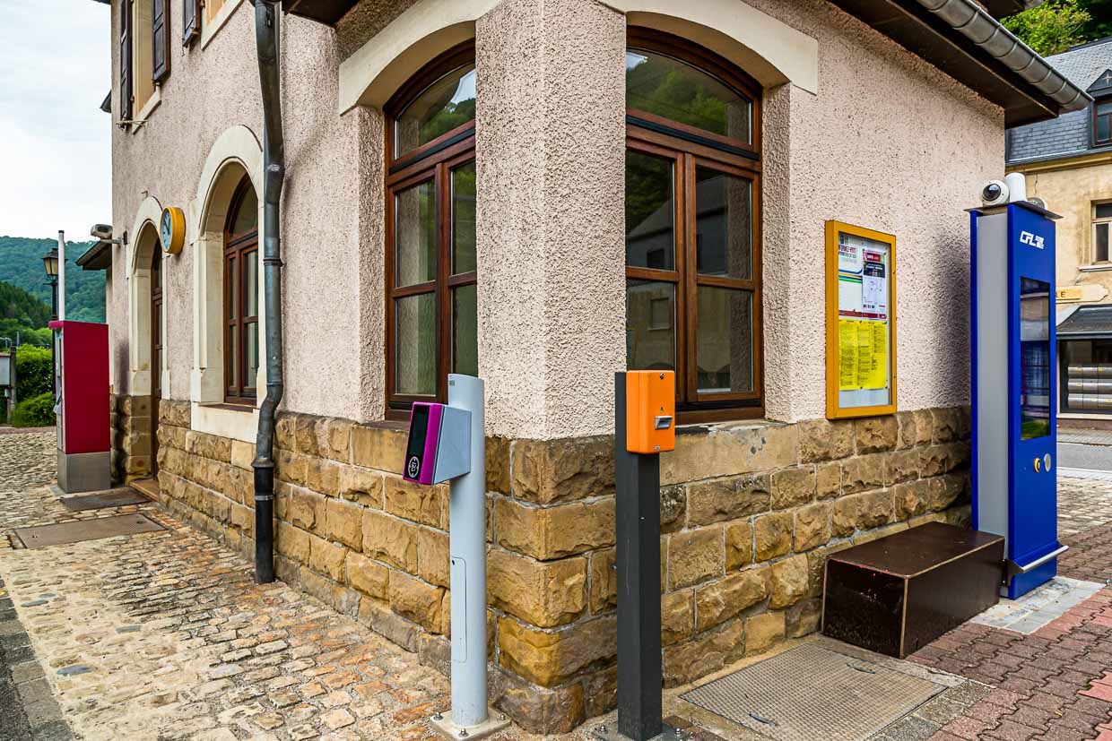
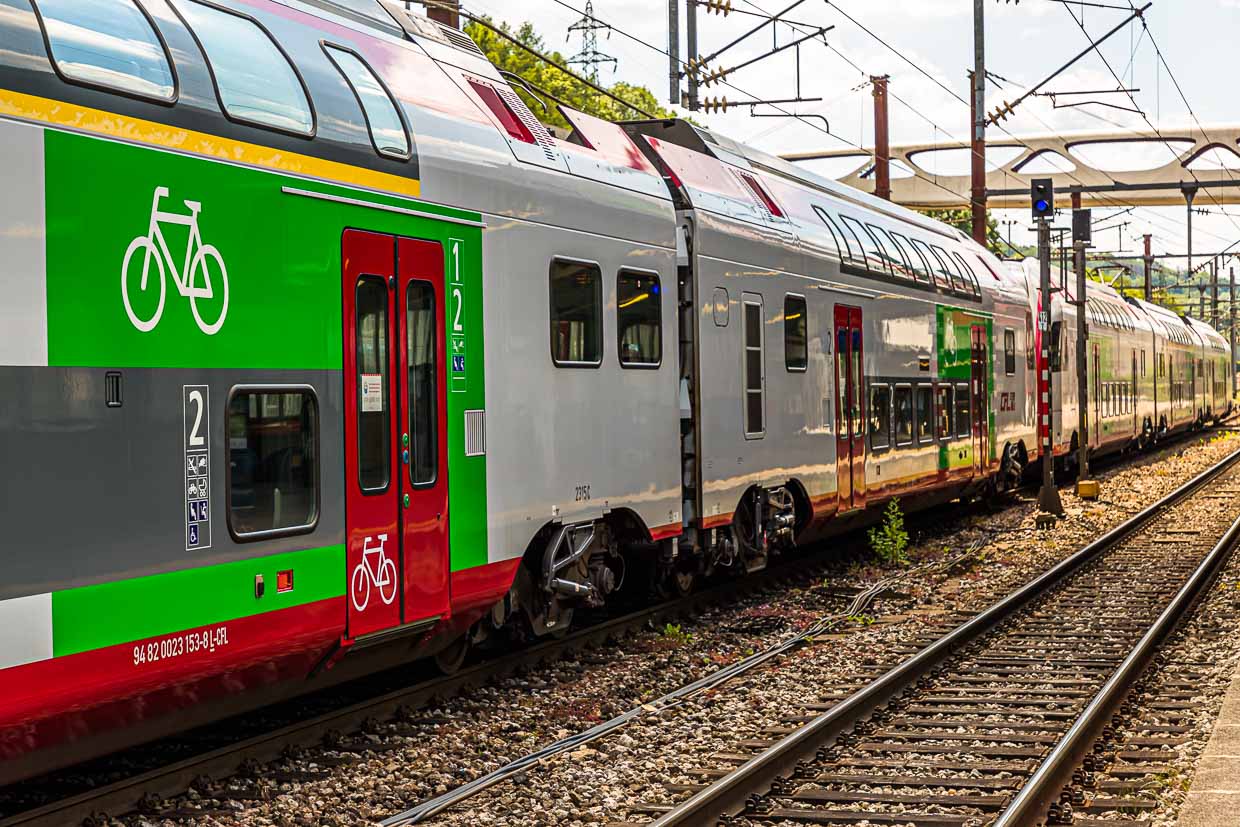
By bus and train free of charge through the whole country? A suitcase that accompanies you but never gets annoying? That sounds almost too good to be true. We tested this offer, which Luxembourg makes to its residents and visitors, for a week and were on foot in five hiking regions. We covered the distances between the walks in the Éislek region in the north, the Müllerthal region, the Moselle region near Grevenmacher, Luxembourg City and the Minett region near Esch-sur-Alzette in the south of Luxembourg by bus and train.
On bike or on foot
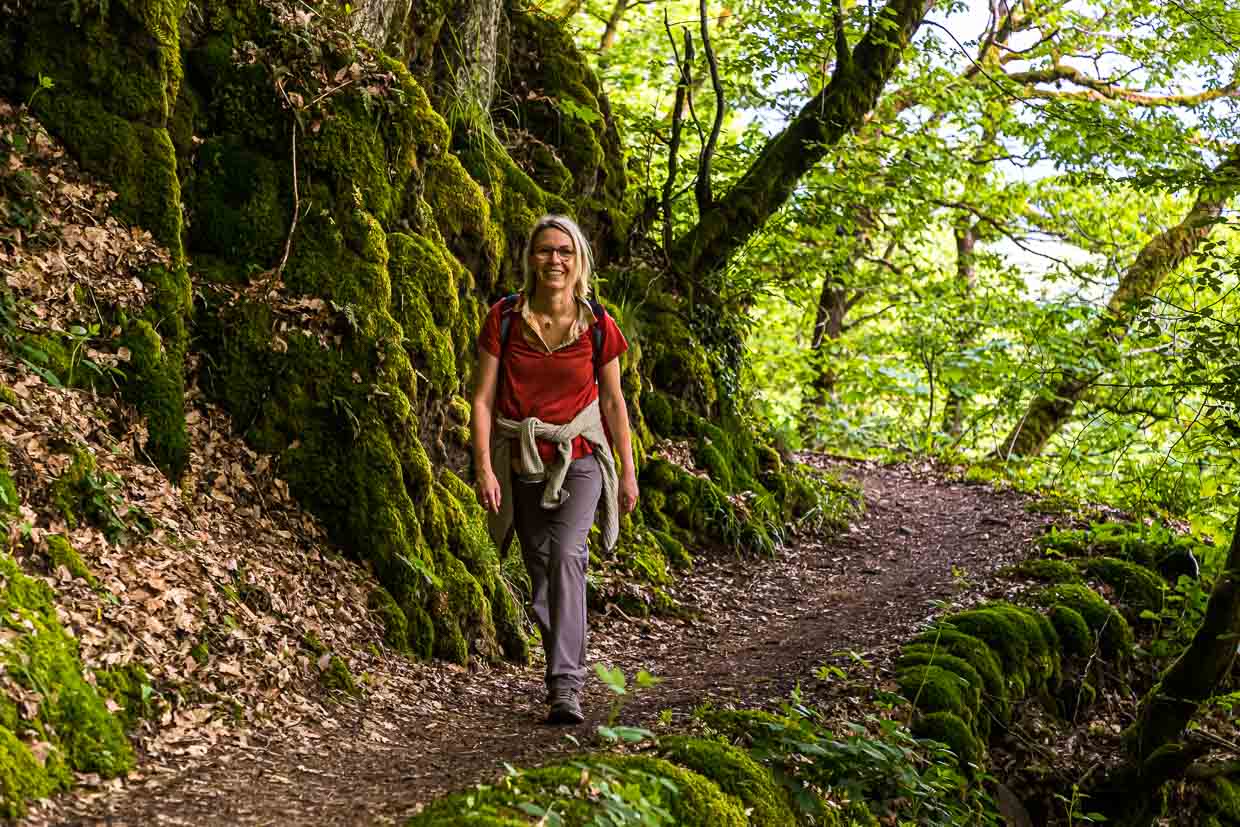
Luxembourg has 3,500 kilometers of signposted hiking trails and 600 kilometers of bike paths. The new Move – We Carry luggage service makes traveling through Luxembourg especially uncomplicated. No matter if you have booked a hotel, a vacation apartment or a camping site, your luggage will be there in front of you at every stage of the day. Hiking or biking carefree during the day and being able to pick up your luggage in the evening is an attractive vacation service.
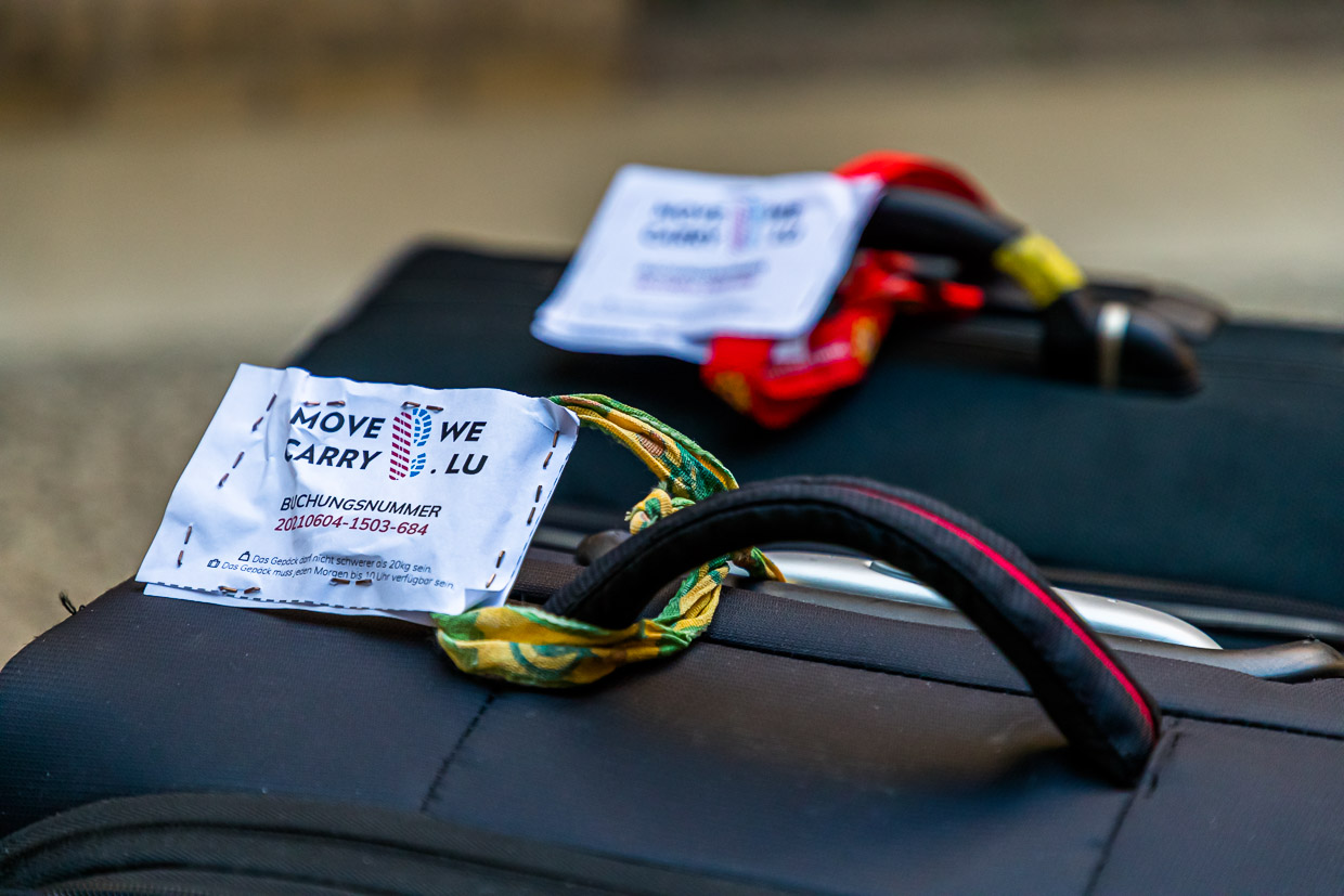
Suitcases, backpacks or bicycle bags are transported. A maximum of two pieces of luggage per person and a total weight of 20 kg may have the luggage, which is collected after 10 am and is ready by 4 pm at the latest at the next stage destination. The Grand Duchy of Luxembourg has offered Move We Carry free of charge until September 30, 2021.
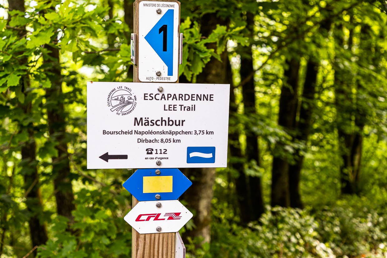
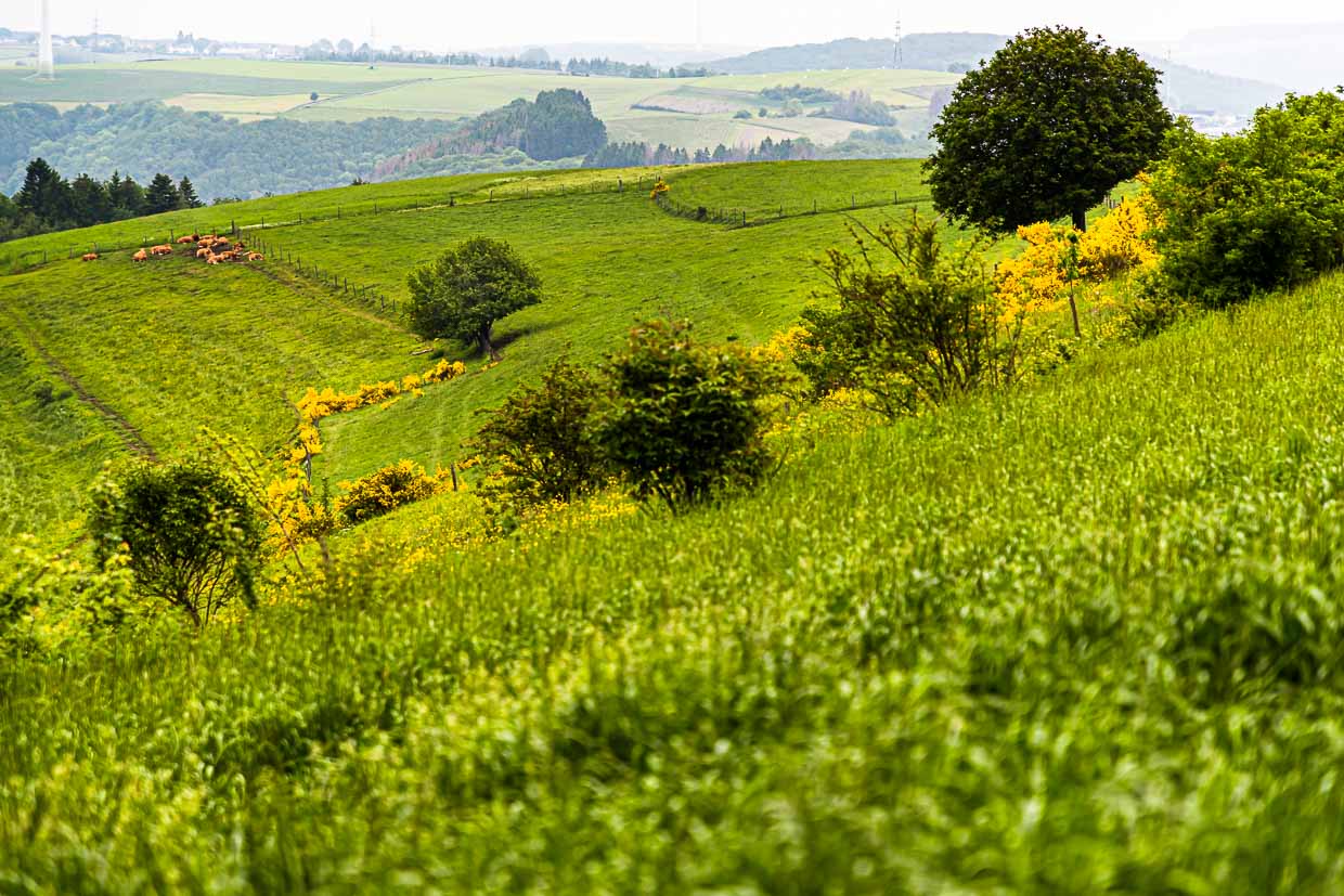
Luxembourg Ardennes – Escapardenne Lee Trail
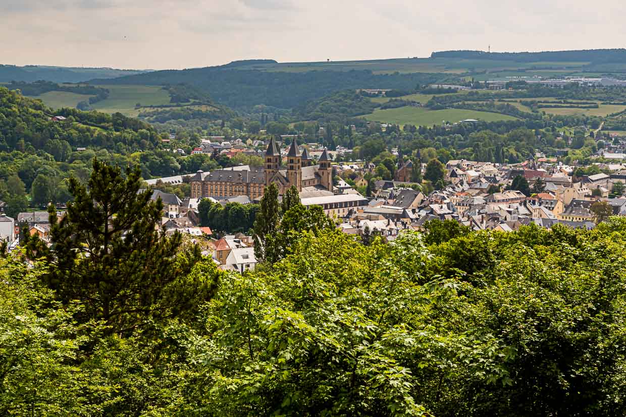
The Éislek region in the north of Luxembourg is crisscrossed by valleys and plateaus with panoramic views, medieval castles and idyllic villages. We hike a section of the 52-kilometer Leading Quality Trail – Best of Europe from Bourscheid-Moulin to Hoscheid. The entire trail can be completed in three days and leads from Ettelbrück to Kautenbach. A hiking pleasure with 2,000 meters of altitude, which rewards you with great views. Lee means ridge in Luxembourgish and the Escarpadenne Lee Trail offers plenty of them.
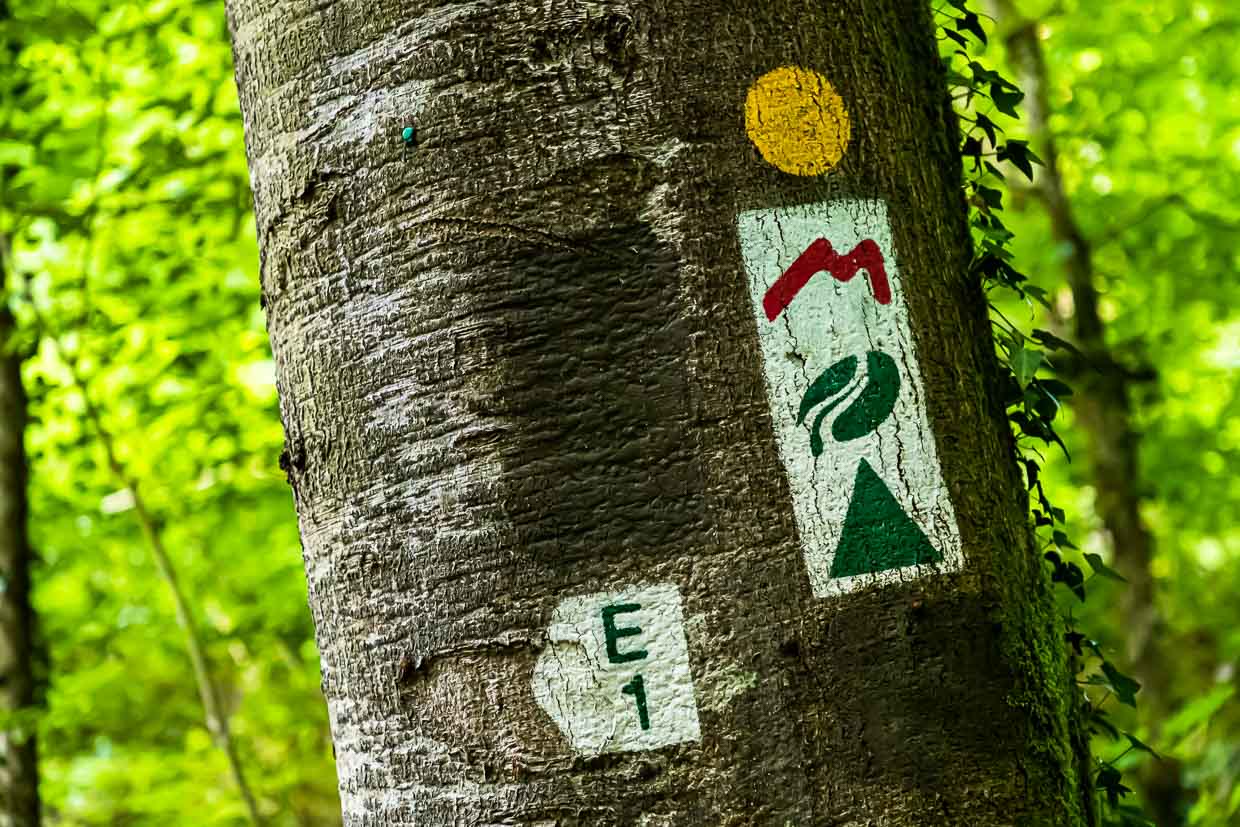
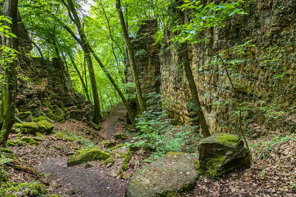
The Mullerthal – over rocks and through gorges
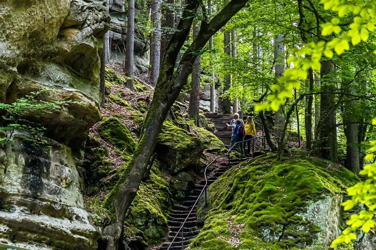
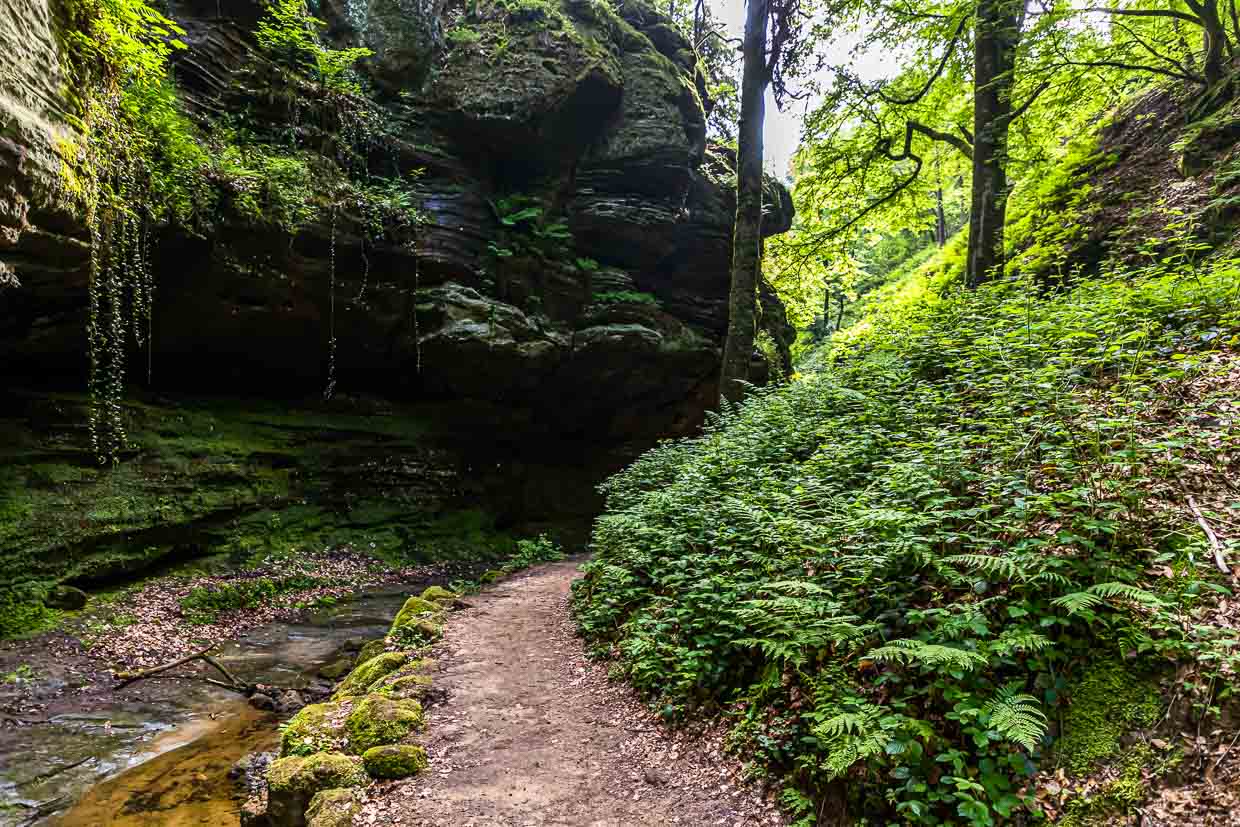
The Müllerthal is the most famous hiking region in Luxembourg. The Wolfsschlucht (Wolf Gorge) with its steep rocks up to 50 meters high is considered the most spectacular natural monument on the 13.5 kilometer long hiking trail E. Whoever sets off from Berdorf in the direction of Echternach, the oldest city in Luxembourg, crosses a beautiful stream valley with equally impressive rock formations made of sandstone beforehand.
The Moselle Region – Dream Loops and Pleasure Hiking

There are three certified premium trails in the Moselle region. The dream loops offer a lot of variety and run mostly on narrow, natural paths. The Traumschleife with its starting point in the small Mosel village of Ahn leads along old vineyard steps and shell limestone rocks. It passes through the steep vineyards of the Palmberg with its old boxwood. At the end of the walking loop, you can reward yourself with a glass of Moselle wine and taste what wines the terroir you have just walked through produces.
Mobility in Luxembourg City
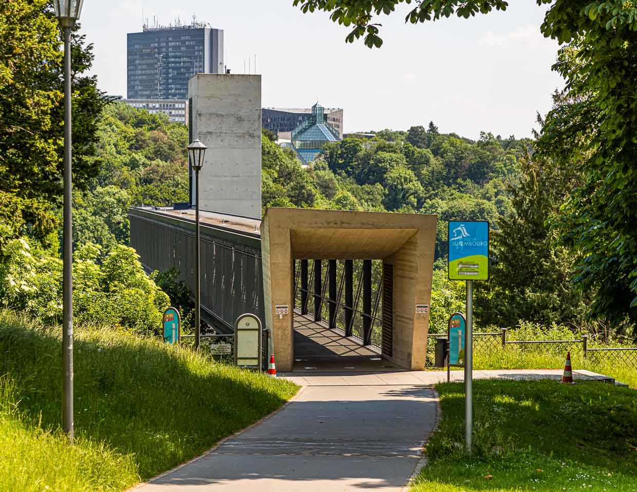
The capital of the Grand Duchy is very green. Apart from the many parks and squares, this is mainly due to the river valleys that surround the city. One moves in a forward-looking urban world and mobility is very smartly implemented here. For example, the Pfaffenthal panoramic elevator takes passengers with and without bicycles from the upper city center to the Alzette Valley in just 30 seconds. Cars had to give up part of the road to cyclists. Some bridges also have a separate floor for cyclists. First e-buses run through downtown and for skaters there is a huge training facility in the middle of the park.
The Minett Region – The Land of Red Earth – ESCH2022

The Minett region in the south owes its name to the bright red iron ore that gives the earth here its color and made steel industry possible in Luxembourg. In the meantime, an impressive structural change has taken place. The University of Luxembourg, for example, was built with partly futuristic buildings in the middle of the area between old blast furnaces and ruins of the steel industry. A walk across the Belval campus is worthwhile. It is only one train station away from Esch-sur-Alzette. You can’t help but marvel at the successful fusion of massive industrial culture and futuristic architecture. Esch-sur-Alzette is the largest city in Luxembourg and will be the European Capital of Culture in 2022. The entire Minett region has already been recognized as a Unesco Biosphere Reserve in 2020. Here you can observe how nature is reclaiming the former mining territory.
The Müller Valley – over rocks and through gorges
The Müllerthal is the most famous hiking region in Luxembourg. It is also called the Little Switzerland of Luxembourg. The Müllerthal Trail belongs to the Leading Quality Trails – Best of Europe. This label is awarded by the European Hiking Association.
The Müllerthal Trail is also suitable for families with younger children. The cross-border orientation of the trail is attractive. Together with the Southern Eifel region in Germany, a NatureHikingPark Delux was created, which makes cross-border hiking possible on four rock tours.
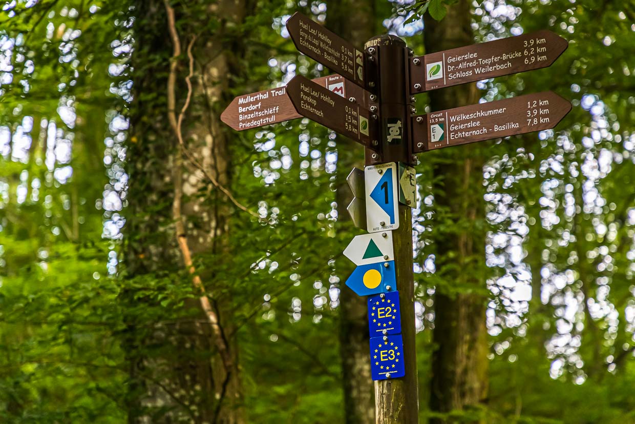
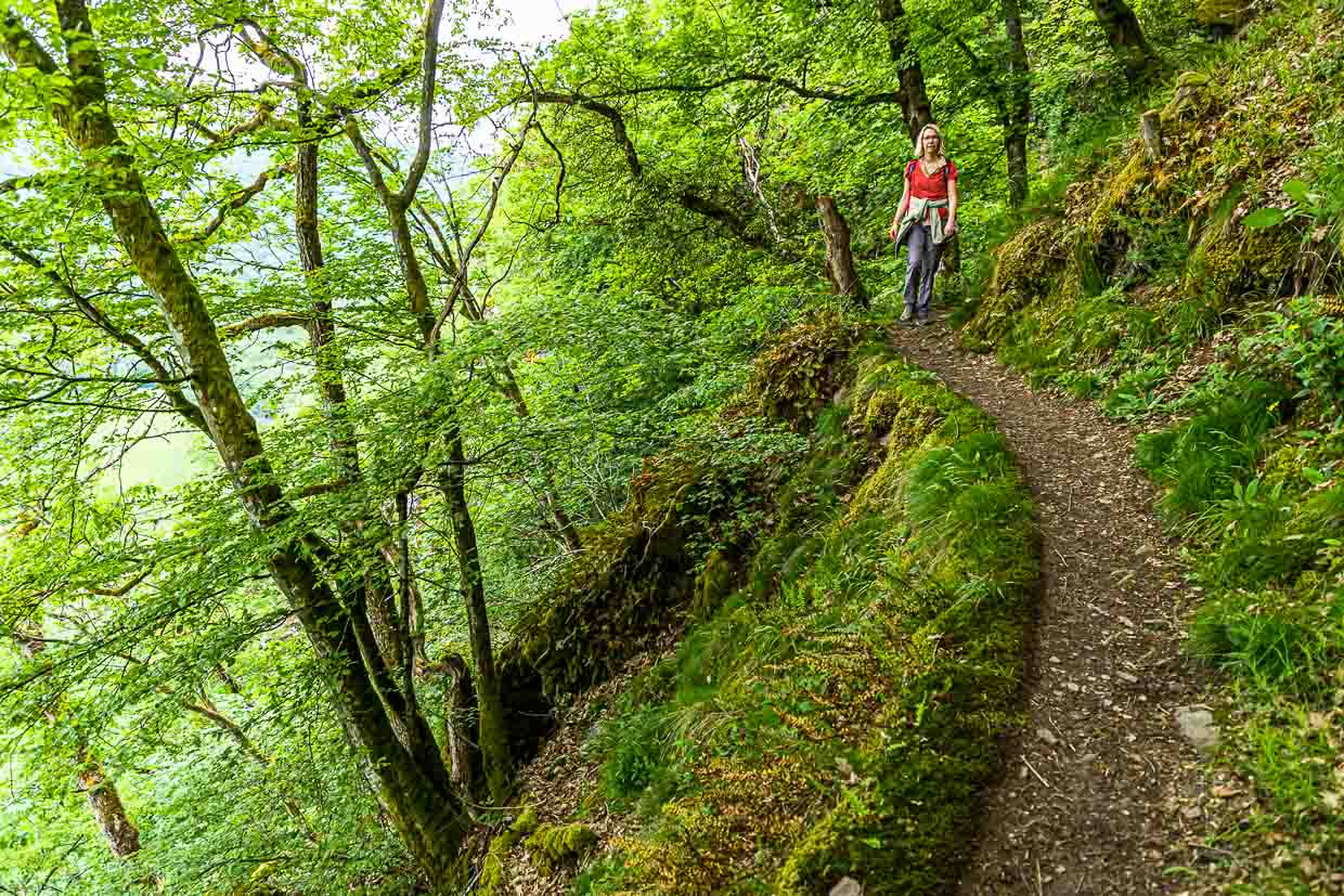
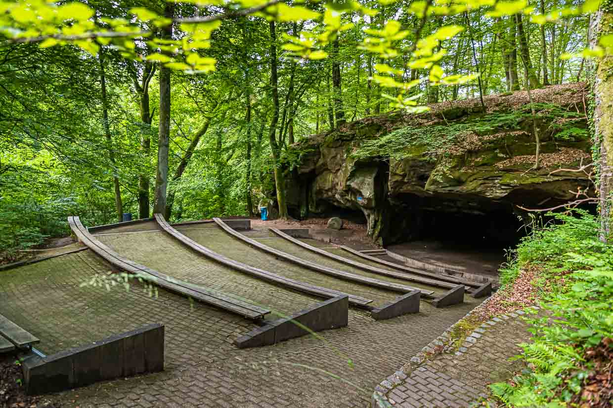
The Müllerthal Trail, which is about 112 km long, is made up of three loops. We start the trail in Berdorf. Surrounded by the Berdorf rocks, the village is located on a plateau and is an ideal starting point for numerous hikes. The hike leads through a forest and rocky landscape via the Wolf Gorge to Echternach. Shortly after leaving Berdorf behind, you reach an amphitheater where millstones were mined in the past, which has left typical traces. Today the amphitheater is used for events. Also on the Huel Lee, the Hohllay, you can clearly see the circular protrusions from which millstones were quarried here for the whole region.
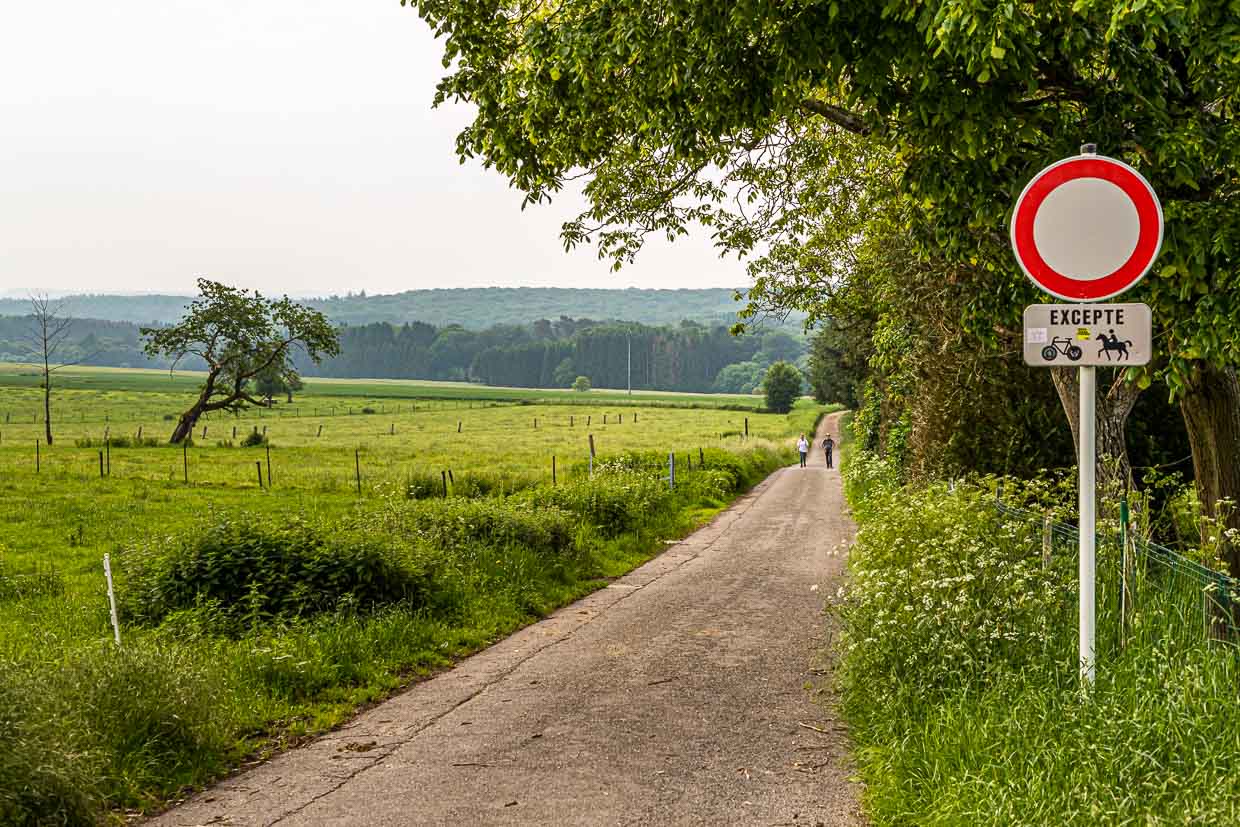
Along the shallowly rippling Aesbach we go to the Perekop. A narrow hiking trail runs parallel to the brook. The sun flashes through the leaves again and again. It is still very quiet here in the early morning. A man is walking his dogs, otherwise you can only hear the birds singing.
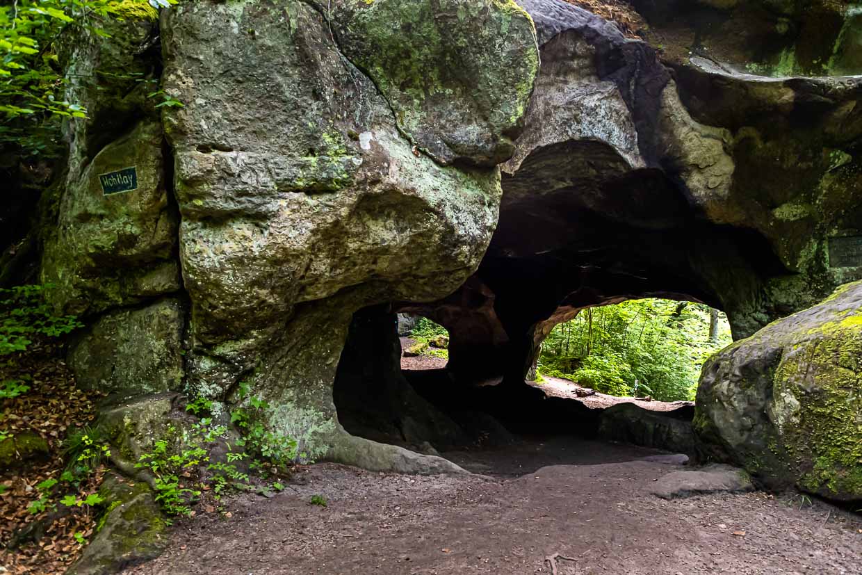
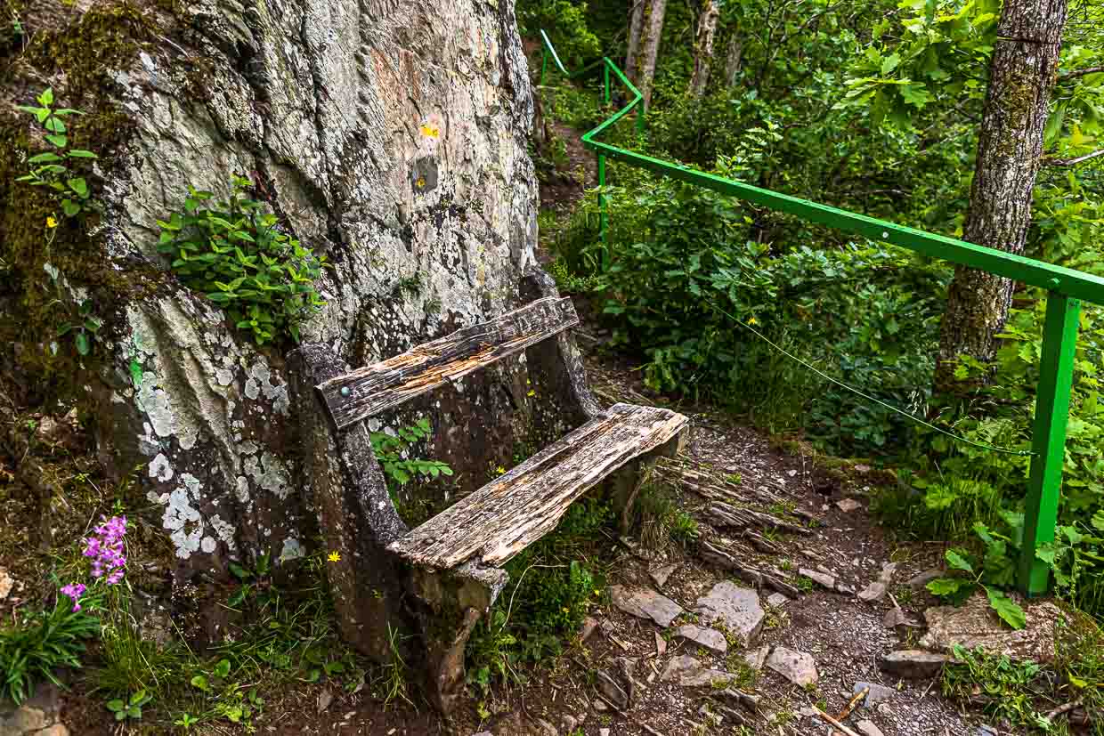
Perekop is a large rock that can be climbed through a crevice by ladders. To reassure you, you don’t have to go back down the steep ladder through the crevice. Outside, a more accommodating staircase leads around the perekop, which takes you back across the road to the hiking trail towards Echternach.
The Wolf Gorge, with its steep cliffs up to 50 meters high, is considered the most spectacular natural monument on the 13.5-kilometer-long hiking trail E. The gorge with the eerily attractive name is a steeply sloping rock crevice where wolves used to find shelter.
Echternach – oldest city in Luxembourg
An ideal starting point or, as in our case, a tempting hiking destination is Echternach. The oldest city in Luxembourg and the cultural and tourist center of the region has a good selection of restaurants, cafes and stores. Visible from afar is the basilica.
Arriving in Echternach, we meet Caroline Nockels. Just before the outbreak of the pandemic, the Echternach resident had decided to try something new and open a café in the old business premises where her grandparents ran a bakery in the 1950s. Her grandmother Irene was then also her first guest at the opening in July 2020.

At Carli’s Coffee near Echternach’s market square, you can get baked goods made from regional ingredients, from pancakes and toasts to muffins or the orange cake made according to grandfather’s recipe. From breakfast to afternoon coffee, Caorline Nockels is open for guests.
The Moselle region with vineyards and orchards
We leave Echternach by bus and head for another hiking region. With the free public transport we go through the Sûre valley towards the Moselle to Grevenmacher, the wine-growing region of Luxembourg. By bus we drive through open landscapes, wooded areas and again and again we can see scattered orchards. Before we reach the Moselle town of Grevenmacher, we make a stop in Born. This small town has been the home of the first and only cider producer in the country for a good five years.
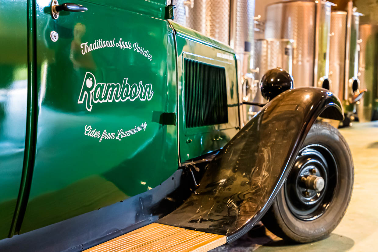
Ramborn is a made-up word from Rambo, an old Luxembourg apple variety, and the village of Born. The traditional craft of cider making has been practiced in the Born area for as long as there have been fruit trees in the Sauer Valley. Three friends from Born remembered this during a visit to Scotland and realized the idea of breathing new life into the old tradition in Luxembourg as well. An 18th century farm has been renovated and has become the production and presentation site for their apple and pear ciders. Meanwhile, more than 100 farmers deliver their fruit from the orchards to Ramborn.

The stopover in Born is well worth it. Tours and tastings are offered regularly. The taste of Ramborn Cider or Perry, made from pears from pear trees that are 250 years old in some cases, is complex and flavorful. While many cider producers use plantation fruit, Ramborn’s ciders contain only the juice of old fruit varieties.
The Luxembourg Ardennes – on the Escapardenne Lee Trail
The Éislek region in the north of Luxembourg is crisscrossed by valleys and plateaus with panoramic views, medieval castles and idyllic villages. We are on a section of the 52-kilometer Leading Quality Trail – Best of Europe. The entire trail can be completed in three days and leads from Ettelbrück to Kautenbach. It is a hiking pleasure with 2,000 meters of altitude gain that rewards you with great views. Lee means rocky ridge in Luxembourgish and the Escapardenne Lee Trail offers plenty of them.
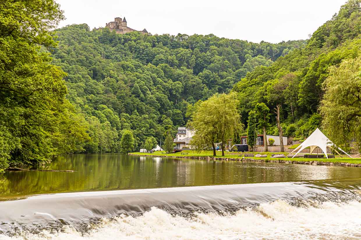
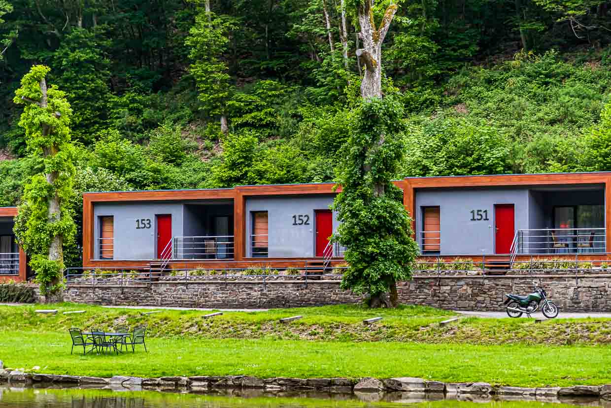
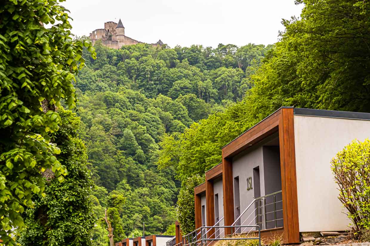
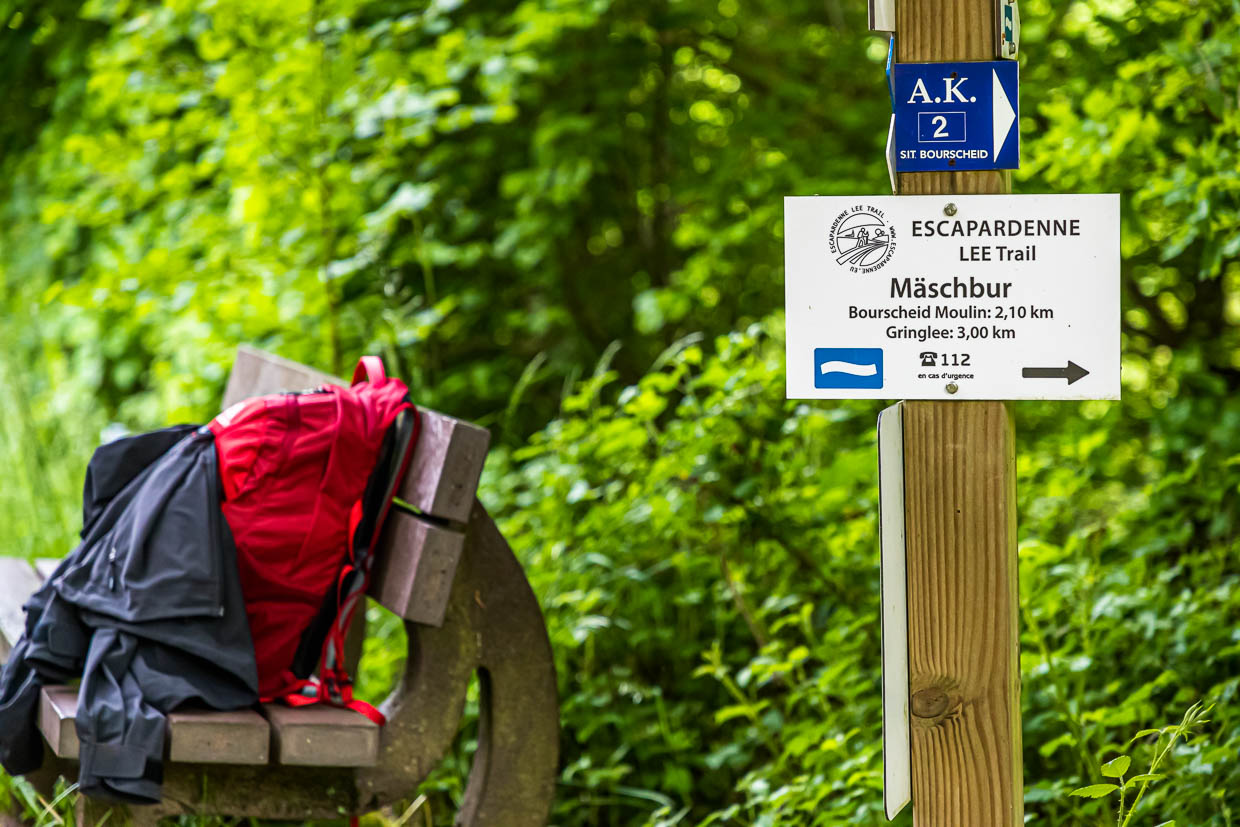
The middle stage of the Escapadenne Lee Trail is 19 kilometers long and, with a good 900 meters of altitude gain, also the most demanding of the three sections through the Éislek region. It goes from Bourscheid-Moulin on the Sûre River to Hoscheid on the Ardennes plateau. In Burscheid-Moulin there are numerous accommodation options. Two hotels, cottage suites overlooking the river, and also a campground line the banks.
You should pack a lunch for this stage, as there are no places to stop along the way. Enchanted forest paths, rocky outcrops, lonely valleys, passages with blooming broom and every now and then a mountain ridge with a good view, however, offer many picnic opportunities. The sign of the white wave on a blue background is the official logo of the trail and accompanies you reliably along the entire route. In between there are always stage signs of the Escapardenne Lee Trail. Despite the good signposting, it is recommended to switch on a hiking app as your own backup.
Once you have left Burscheid behind, the next hiking stop is the Napoleonsknäppchen, also called Napoleonsbäumchen. It is located on a high plateau and is visible from afar. Except for a tree and the viewing platform, there is – almost – nothing else to see here. However, a farmer has placed a huge and also clearly visible manure pile next to the tree. This seems disrespectful at first, but maybe it’s good for the tree itself.
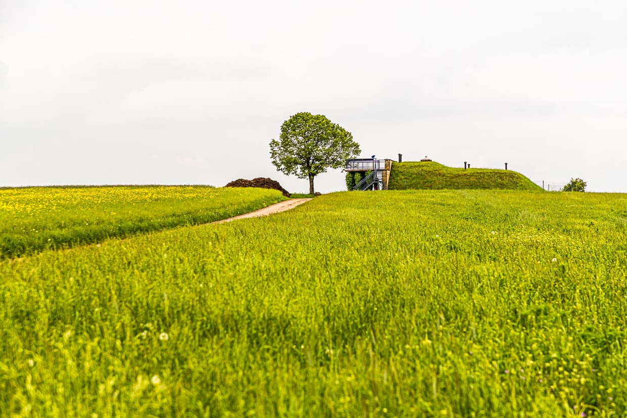
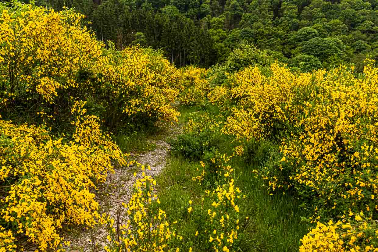
Back to the historical significance of the Napoleon’s Knapchen. The original tree was planted in 1811 in honor of the birth of Napoleon Bonaparte’s son. In 1940, this tree was cut down by the Nazis. But only a year later the local residents planted that linden tree, which still stands there today. After the excursion across the plateau, we continue through gorse bushes, which bloom profusely in June, and back into the forest.
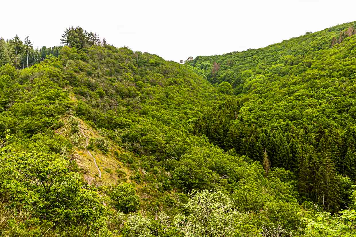
What follows now is definitely one of the highlights of the trail. Via a steep path you climb the Molberlee ridge. It is a narrow path a good 500 meters long. To the left and to the right the only sparsely overgrown rock drops steeply. One walks over almost fine-leaved slates. The Mollbier, in German Heidelbeere, gives the ridge its name. This point is certainly one of the most beautiful in the Luxembourg Ardennes. The stage ends on a high plateau in the village of Hoscheid.
Boarding please! Free ride through Luxembourg
After a week of hiking in Luxembourg, we can say it was a trip without any ticket stress and with a lot of room for maneuvering. In time you should take a look at the bus connections in the countryside. Often there is only one connection per hour. It’s worth checking the route planner of the central mobility app, which displays departures in real time. Tip: in the border area Moselle region, one of our cell phones has always ventured into the weak German network. This resulted in the Luxembourg mobility app not working. With dial-up to the Luxembourg mobile network, on the other hand, everything went smoothly. As a personal backup for the hike, you should still use a hiking app. Mostly, the hiking trails are very well signposted, but sometimes too many trail names led to uncertainty. Then a look at the hiking route in the app always helped.
With Move We Carry, travelers can organize luggage transport in advance.
The research trip was partly supported on site by Luxembourg Tourism